


PRECINCT THOMPSON TOWNSHIP, Seneca County, Ohio
About
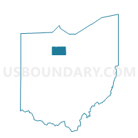
Outline

Summary
| Unique Area Identifier | 651629 |
| Name | PRECINCT THOMPSON TOWNSHIP |
| County | Seneca County |
| State | Ohio |
| Area (square miles) | 37.34 |
| Land Area (square miles) | 37.33 |
| Water Area (square miles) | 0.01 |
| % of Land Area | 99.97 |
| % of Water Area | 0.03 |
| Latitude of the Internal Point | 41.20285330 |
| Longtitude of the Internal Point | -82.88906790 |
Maps


Graphs
Select a template below for downloading or customizing gragh for PRECINCT THOMPSON TOWNSHIP, Seneca County, Ohio


Neighbors
Neighoring Voting District (by Name) Neighboring Voting District on the Map
- BELLEVUE 3, Huron County, OH
- Voting District GREEN CREEK B, Sandusky County, OH
- LYME TWP, Huron County, OH
- PRECINCT ADAMS TOWNSHIP, Seneca County, OH
- PRECINCT REED TOWNSHIP, Seneca County, OH
- PRECINCT SCIPIO TOWNSHIP, Seneca County, OH
- SHERMAN TWP, Huron County, OH
- Voting District YORK B, Sandusky County, OH
- Voting District YORK C, Sandusky County, OH
Top 10 Neighboring County Subdivision (by Population) Neighboring County Subdivision on the Map
- Bellevue city, Huron County, OH (3,673)
- Green Creek township, Sandusky County, OH (3,646)
- York township, Sandusky County, OH (2,532)
- Scipio township, Seneca County, OH (1,729)
- Thompson township, Seneca County, OH (1,443)
- Adams township, Seneca County, OH (1,320)
- Lyme township, Huron County, OH (853)
- Reed township, Seneca County, OH (848)
- Sherman township, Huron County, OH (510)
Top 10 Neighboring Place (by Population) Neighboring Place on the Map
Top 10 Neighboring Unified School District (by Population) Neighboring Unified School District on the Map
- Bellevue City School District, OH (13,351)
- Clyde-Green Springs Exempted Village School District, OH (12,871)
- Seneca East Local School District, OH (5,152)
Top 10 Neighboring State Legislative District Lower Chamber (by Population) Neighboring State Legislative District Lower Chamber on the Map
Top 10 Neighboring State Legislative District Upper Chamber (by Population) Neighboring State Legislative District Upper Chamber on the Map
Top 10 Neighboring 111th Congressional District (by Population) Neighboring 111th Congressional District on the Map
Top 10 Neighboring Census Tract (by Population) Neighboring Census Tract on the Map
- Census Tract 9621, Sandusky County, OH (5,008)
- Census Tract 9622, Sandusky County, OH (4,388)
- Census Tract 9159, Huron County, OH (4,190)
- Census Tract 9626, Seneca County, OH (4,129)
- Census Tract 9160, Huron County, OH (4,015)
- Census Tract 9625, Seneca County, OH (3,928)